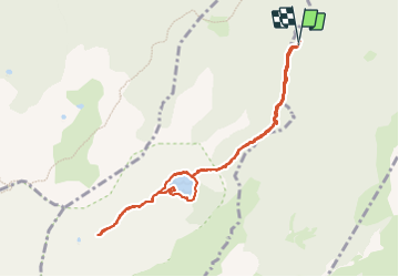
![](/images/other/stat-length.png)
![Excursión Senderismo Le Pla - Laurenti - Photo](https://media.geolcdn.com/t/1900/400/ext.pjpeg?maxdim=2&url=https%3A%2F%2Fstatic1.geolcdn.com%2Fsiteimages%2Fupload%2Ffiles%2F1553511878bg_sport_marche.png)
Laurenti
suresnois
Usuario
![Longitud](/images/other/stat-length.png)
![Altitud máxima](https://static1.geolcdn.com/siteimages/upload/files/1508320355ic_sort_altitude_max_24dp.png)
![Desnivel positivo](https://static1.geolcdn.com/siteimages/upload/files/1508320355ic_sort_den_pos_24dp.png)
![Km-Effort](/images/other/stat-length.png)
![Altitud mínima](https://static1.geolcdn.com/siteimages/upload/files/1508320355ic_sort_altitude_min_24dp.png)
![Desnivel negativo](https://static1.geolcdn.com/siteimages/upload/files/1508320355ic_sort_den_neg_24dp.png)
![Boucle](https://static1.geolcdn.com/siteimages/upload/files/16400158638029165_repeat_loop_refresh_sync_direction_icon.png)
![Senderismo](https://static1.geolcdn.com/sitytour/trail-icons/101.png)
6h21
Dificultad : Difícil
![Escanee este código QR para abrir la excursión en la aplicación SityTrail](https://capi.geolives.com/qq0zvz2zws4bq2lad0pu/sitytour/trails/3828242/qr.png?size=200)
Aplicación GPS de excursión GRATIS
A propósito
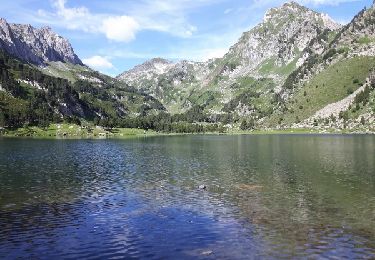
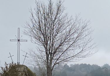
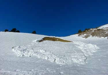
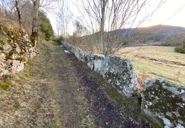
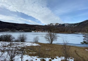
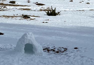
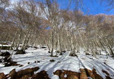
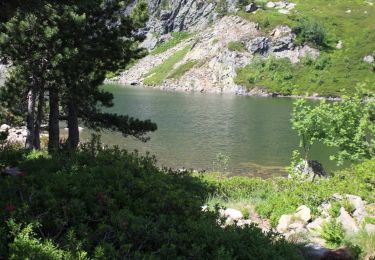
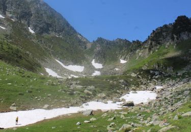
Ruta Senderismo de 10 km a descubrir en Occitania, Ariège, Le Pla. Esta ruta ha sido propuesta por suresnois.
Descripción
Pour info :
Si vous partez seul prévenir un proche de votre itinéraire et de la durée,
Chaussures de marche, bâtons, GPS, carte de la randonnée avec l'itinéraire, trousse premiers secours,,
Apportez suffisamment d'eau, des en cas (fruits sec, barres de céréales,,,)
Selon les saisons : bonnet, gants, vêtements chauds, casquette, lunettes de soleil, crème solaire
Localización
Comentarios
Excursiones cerca
![Excursión Senderismo Le Pla - Roc Blanc par Laurenti - Photo](https://media.geolcdn.com/t/375/260/ext.jpg?maxdim=2&url=https%3A%2F%2Fservices.sitytrail.com%2FGeolivesWS%2FDownloadMedia.ashx%3FTrailID%3D781780%26Media%3Dfix__20170627095153.jpg)
![Senderismo Senderismo](https://static1.geolcdn.com/sitytour/trail-icons/101.png)
Senderismo
![](/images/other/stat-length.png)
![](https://static1.geolcdn.com/siteimages/upload/files/16400158638029165_repeat_loop_refresh_sync_direction_icon.png)
![Excursión Senderismo Quérigut - Le Puch Carcanieres Querigut dans les nuages - Photo](https://media.geolcdn.com/t/375/260/92fc3c28-6949-414d-b338-994a22d42f23.jpg&format=jpg&maxdim=2)
![Senderismo Senderismo](https://static1.geolcdn.com/sitytour/trail-icons/101.png)
Senderismo
![](/images/other/stat-length.png)
![](https://static1.geolcdn.com/siteimages/upload/files/16400158638029165_repeat_loop_refresh_sync_direction_icon.png)
![Excursión Senderismo Mijanès - Col de pailheres depuis station Mijanes Pic du Ginesta - Photo](https://media.geolcdn.com/t/375/260/ddd6575f-2693-4b08-a18d-9b295d26eac7.jpg&format=jpg&maxdim=2)
![Senderismo Senderismo](https://static1.geolcdn.com/sitytour/trail-icons/101.png)
Senderismo
![](/images/other/stat-length.png)
![](https://static1.geolcdn.com/siteimages/upload/files/16400158638029165_repeat_loop_refresh_sync_direction_icon.png)
![Excursión Senderismo Le Pla - Mijanès Montferrant - Photo](https://media.geolcdn.com/t/375/260/0b09ad5c-bc59-4aaa-9b80-88720e54a38c.jpg&format=jpg&maxdim=2)
![Senderismo Senderismo](https://static1.geolcdn.com/sitytour/trail-icons/101.png)
Senderismo
![](/images/other/stat-length.png)
![](https://static1.geolcdn.com/siteimages/upload/files/16400158638029165_repeat_loop_refresh_sync_direction_icon.png)
![Excursión Senderismo Mijanès - Mijanès prairie d’artigues - Photo](https://media.geolcdn.com/t/375/260/79533b2d-a1d3-41b4-9988-1271346d53fa.jpg&format=jpg&maxdim=2)
![Senderismo Senderismo](https://static1.geolcdn.com/sitytour/trail-icons/101.png)
Senderismo
![](/images/other/stat-length.png)
![](https://static1.geolcdn.com/siteimages/upload/files/16400158638029165_repeat_loop_refresh_sync_direction_icon.png)
![Excursión Raquetas de nieve Mijanès - Mijanes station cabane de la mire - Photo](https://media.geolcdn.com/t/375/260/6b8b834b-8a6e-428b-8c8e-ba7810d44f96.jpg&format=jpg&maxdim=2)
![Raquetas de nieve Raquetas de nieve](https://static1.geolcdn.com/sitytour/trail-icons/504.png)
Raquetas de nieve
![](/images/other/stat-length.png)
![](https://static1.geolcdn.com/siteimages/upload/files/16400158638029165_repeat_loop_refresh_sync_direction_icon.png)
![Excursión Raquetas de nieve Mijanès - Mijanes station col de Pailheres - Photo](https://media.geolcdn.com/t/375/260/35a8dce1-50c7-4801-828e-cf0e36a7892d.jpg&format=jpg&maxdim=2)
![Raquetas de nieve Raquetas de nieve](https://static1.geolcdn.com/sitytour/trail-icons/504.png)
Raquetas de nieve
![](/images/other/stat-length.png)
![](https://static1.geolcdn.com/siteimages/upload/files/16400158638029165_repeat_loop_refresh_sync_direction_icon.png)
![Excursión Senderismo Mijanès - Les 3 étangs de rabassoles - Photo](https://media.geolcdn.com/t/375/260/807f0f4c-4bca-4248-a54c-7fda09f527fc.jpg&format=jpg&maxdim=2)
![Senderismo Senderismo](https://static1.geolcdn.com/sitytour/trail-icons/101.png)
Senderismo
![](/images/other/stat-length.png)
![](https://static1.geolcdn.com/siteimages/upload/files/16400158638029165_repeat_loop_refresh_sync_direction_icon.png)
![Excursión Senderismo Artigues - Au pied du Roc Blanc - Photo](https://media.geolcdn.com/t/375/260/3a4bd5b8-68b2-4eb5-84fb-a8b6503b2686.jpg&format=jpg&maxdim=2)
![Senderismo Senderismo](https://static1.geolcdn.com/sitytour/trail-icons/101.png)
Senderismo
![](/images/other/stat-length.png)
![](https://static1.geolcdn.com/siteimages/upload/files/16400158638029165_repeat_loop_refresh_sync_direction_icon.png)